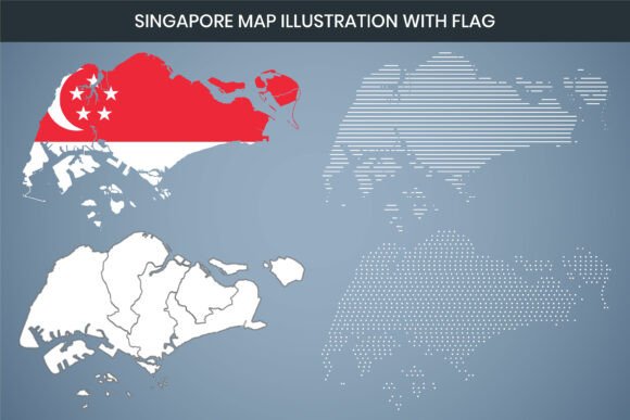
Singapore Map Illustration with Flag: A Practical Guide to This Versatile Design Asset
If you've ever needed a clean, editable map of Singapore that includes the national flag, you know the struggle of finding something that actually works across different tools and formats. The Singapore Map Illustration with Flag fills that gap nicely. It's not just a static image—it's a multi-format design file built for real-world use, whether you're preparing a presentation, designing marketing collateral, or building an infographic for a client.
This particular illustration is a laser-cut style vector map of Singapore integrated with the country's flag design. It comes with a generous set of file formats including AI, SVG, EPS, DXF, PNG, and PDF, plus a Canva-editable version. At 3000 x 2000 pixels and 300 DPI resolution, it's print-ready right out of the box. Let's walk through what that actually means for you and how you might put it to work.
Breaking Down the Key Specifications
Before diving into use cases, it helps to understand what the technical specs mean in practical terms. The Singapore Map Illustration with Flag features a 3000 x 2000 pixel dimension at 300 DPI. That's roughly a 10 x 6.67 inch print at full quality, or larger if you're using it for signage or display work. The 300 DPI resolution ensures crisp output on paper, so you won't get those jagged edges that plague lower-resolution graphics.
The RGB color mode means the file is optimized for screens—monitors, tablets, projectors—but because it's a vector-based design, converting to CMYK for professional printing is straightforward. The laser cut design style gives the map a distinct, modern look with clean lines and a cut-out aesthetic that works well for both digital and physical applications.
File Formats and What They're For
The bundle includes AI, SVG, EPS, DXF, PNG, and PDF formats. Each serves a different purpose:
- AI and EPS are standard for professional designers working in Adobe Illustrator or similar vector editing software. These give you full control over every anchor point, color, and layer.
- SVG is ideal for web use, interactive applications, and embedding in websites or digital documents without losing quality at any zoom level.
- DXF is useful for CAD software, CNC routing, or laser cutting machines. If you run a workshop or fabrication business, this format opens up real physical production possibilities.
- PNG gives you a high-resolution raster image with a transparent background, perfect for quick drag-and-drop use in documents, social media graphics, or slide decks.
- PDF is a universal format that almost anyone can open, view, and print without special software.
The Canva editable file is a nice addition for non-designers or teams that rely on Canva for fast content creation. You can drop it into a Canva project, resize, recolor, and add text without needing Adobe software.
Real-World Applications Across Different Environments
This isn't just a decorative asset. The Singapore Map Illustration with Flag has practical utility across several domains. Let's look at where it fits naturally.
Marketing and Branding Materials
If you're running a campaign targeting the Singapore market or highlighting Singapore-based operations, this map with flag serves as an immediate visual anchor. It can appear on brochures, landing pages, email headers, or trade show banners. The laser cut style gives it a contemporary feel that doesn't look like a generic clip-art map. For a regional office announcement or a Singapore-focused product launch, it helps communicate location and identity without extra explanation.
A client of mine used a similar map illustration in a pitch deck for a Southeast Asian expansion strategy. The visual helped investors immediately identify Singapore as the regional hub, and the clean design kept the slide professional rather than cluttered.
Educational and Training Materials
Teachers, trainers, and course creators can use the Singapore Map Illustration with Flag in presentations, handouts, or e-learning modules. Because the file is fully editable, you can label regions, highlight districts, or overlay data points. The 300 DPI resolution means printed worksheets or posters look sharp, whether in A4 or larger formats.
If you're creating geography or social studies content, having an editable vector map allows you to simplify or emphasize different aspects depending on the lesson. You might strip it down to outline only for a labeling exercise, or keep the flag detail for a lesson on national identity.
Data Visualization and Infographics
One of the stronger use cases for this illustration is as a base map in data visualization. If you're presenting statistics, survey results, or demographic data related to Singapore, the map provides a recognizable frame. You can overlay heat maps, bar charts, or callouts directly on the map in Illustrator or Canva.
The RGB color mode is helpful here because most infographics are viewed on screens—whether on social media, blogs, or in digital reports. And because the map is vector-based, you can scale it down for a thumbnail or up for a poster without any loss of quality.
Digital and Web Design
For web designers and developers, the SVG format is particularly valuable. You can embed it directly into HTML, style it with CSS, or animate it with JavaScript. The transparent background means it integrates cleanly with any site design. The flag integration already gives it a recognizable color palette, which can inform or complement your overall design scheme.
I've seen similar map illustrations used as hero images on regional landing pages, as icons in navigation menus, and as background elements in newsletter templates. The key advantage is that the SVG remains crisp on retina displays and at any viewport size.
Physical Production and Fabrication
This is where the DXF format breaks new ground. If you have access to a laser cutter, CNC router, or vinyl cutter, you can produce physical versions of this map. Think custom signage, acrylic displays, wooden wall art, or vinyl decals for office windows. The laser cut design style translates directly to physical cutting paths, so what you see on screen matches what you can produce in material.
Small business owners and hobbyists running Etsy shops or local craft brands could create Singapore-themed merchandise—keychains, coasters, wall plaques, or even cake toppers—using this file as the base template.
Practical Benefits and What Makes It Useful
The Singapore Map Illustration with Flag isn't novel because of its subject matter—Singapore map illustrations are widely available. What sets this one apart is the combination of resolution, format variety, and editability. Here are the practical benefits worth noting:
- Time savings. You don't need to source a map, add a flag, and clean up the edges. It's already done, and you can edit it further if needed.
- Cross-platform compatibility. With files for Adobe Suite, Canva, web, CAD, and print, you're not locked into one ecosystem.
- Print and screen ready. The 300 DPI resolution and RGB mode give you flexibility for both outputs without needing to regenerate assets.
- Professional appearance. The laser cut style is intentional and polished—it doesn't look like a screenshot or a rushed clip art find.
- Royalty-free licensing. You can use it in commercial projects without ongoing fees or attribution requirements, assuming standard royalty-free terms apply.
Considerations When Using the File
While the Singapore Map Illustration with Flag is versatile, there are a few practical things to keep in mind depending on your workflow:
- Check the software requirements. AI and EPS files require vector editing software like Adobe Illustrator or Affinity Designer. If you're using free tools, stick with SVG or PNG.
- Understand the flag design. The flag is integrated into the map design. If you need just the map outline without the flag pattern, you'll need to edit the vector file to remove or alter that layer.
- Color adjustments. Because the file is in RGB, if you're sending it to a commercial printer that requires CMYK, you'll need to convert and possibly adjust colors to avoid dulling of the red or white in the flag.
- Scaling limits. While vector files can scale infinitely, the PNG version has fixed dimensions. If you're using the PNG, keep it within reasonable size limits to avoid pixelation.
- Laser cutting prep. For DXF users, double-check your cutting machine's requirements for line thickness and closed paths. Some vectors may need minor cleanup before cutting.
Final Observations
The Singapore Map Illustration with Flag is a well-rounded asset for anyone who regularly works with location-based visuals. It saves time, offers format flexibility, and maintains a professional standard across both digital and print environments. Whether you're a marketer preparing a campaign for a Singapore launch, an educator building a regional geography module, or a maker producing physical goods, this file gives you a solid foundation without requiring design work from scratch.
The inclusion of DXF and Canva formats shows an understanding of the different ways people actually work today—not everyone is a full-time designer, and not every project ends up on a screen. If your workflow touches Singapore geography in any capacity, this illustration is worth having in your toolkit.